Ground Station Software
The free PTHSonde ground-station app — a live Skew-T workstation with time-series telemetry, full SPC sounding analysis, a GPS map with GFS landing prediction, a balloon fill calculator, and link health.
Docs & downloads
Overview
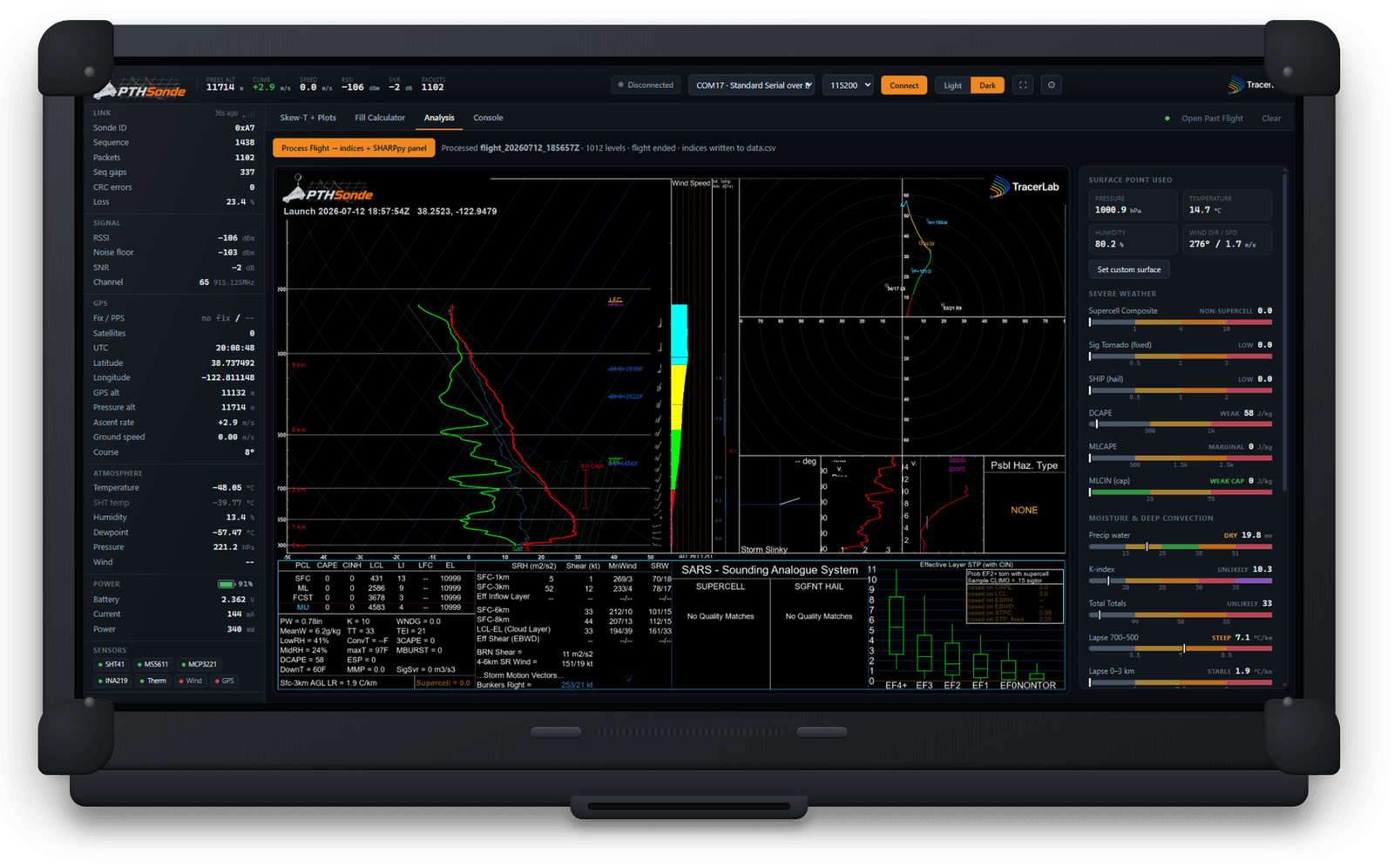
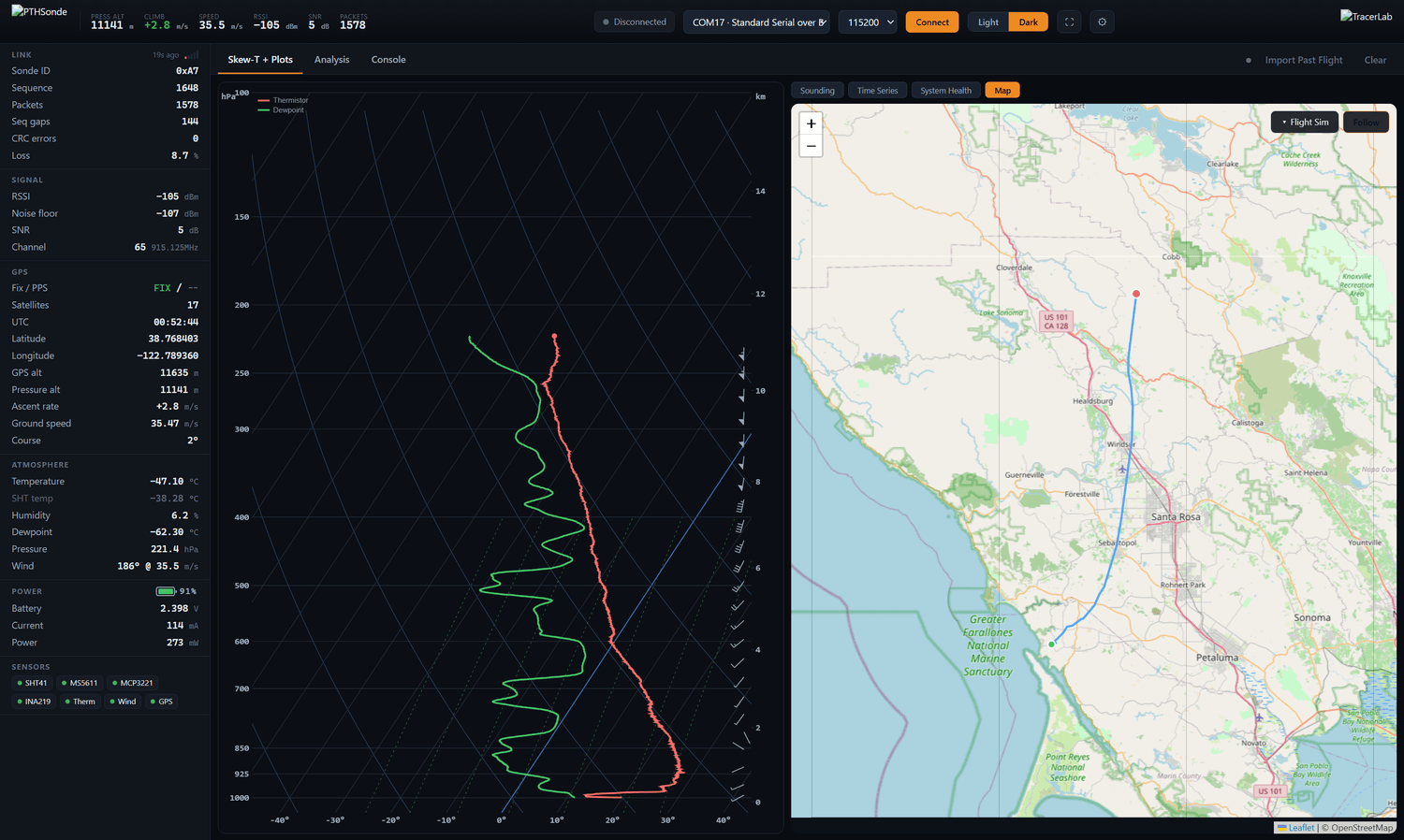
The ground-station app turns the telemetry your receiver decodes into a full sounding-and-flight workstation. A live Skew-T and profiles build as packets arrive, one click renders a complete SPC severe-weather panel, and a GPS map with a GFS-driven landing predictor helps you plan the recovery. It runs as a Windows app or right in your browser.
Highlights
Why it's different
A live sounding as it flies
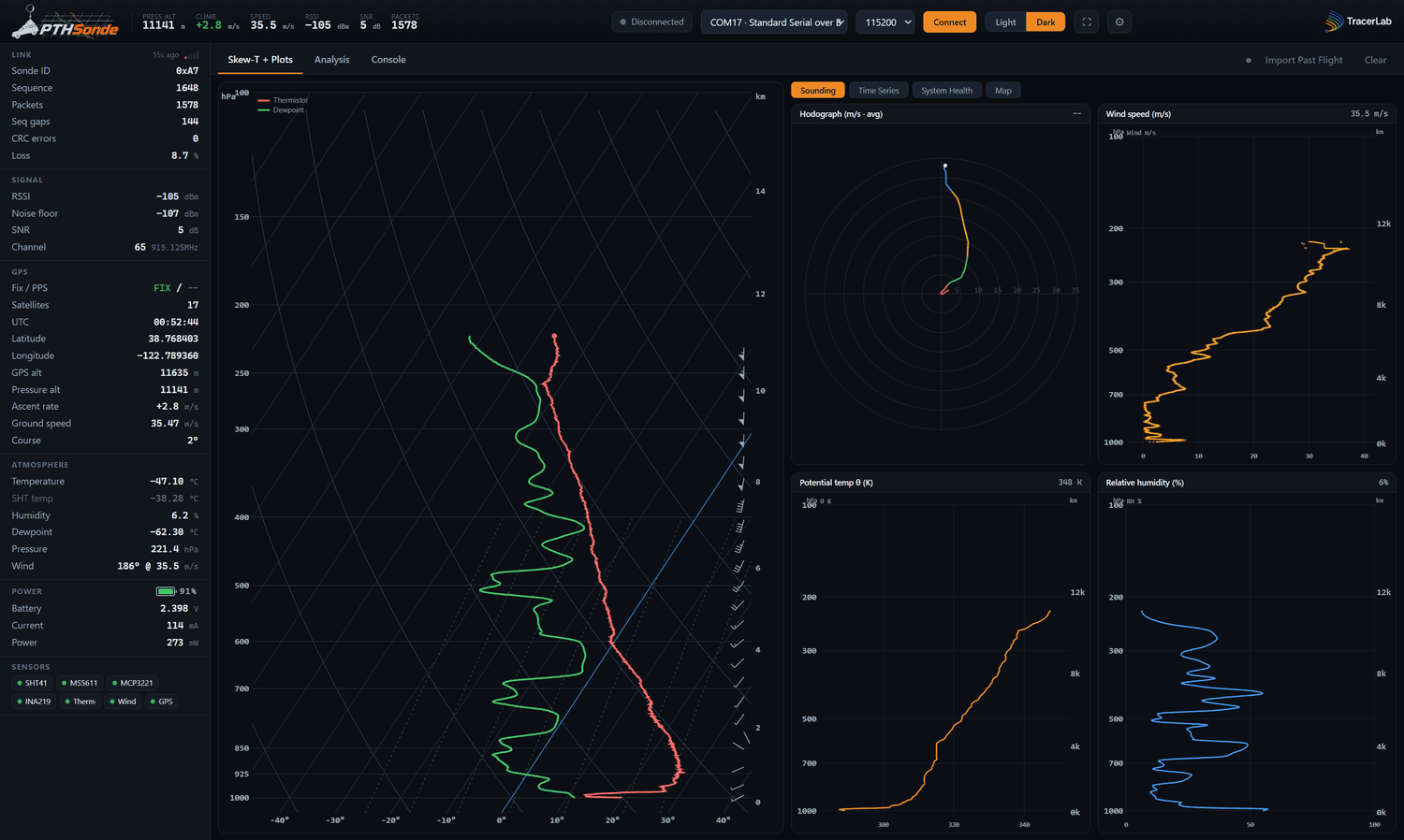
Skew-T, hodograph, and wind/θ/humidity profiles build in real time from your own telemetry, with the profile carried the whole ascent by the onboard pressure sensor.
Full severe-weather analysis
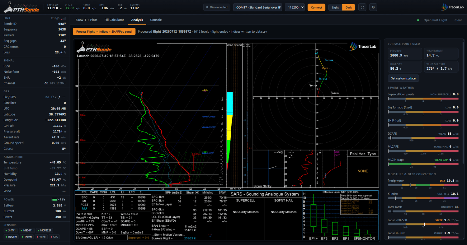
One click produces a complete SPC sounding panel — CAPE, shear, SRH, STP/SHIP composites, SARS analogs, and EF-probabilities.
Plan the flight and the recovery
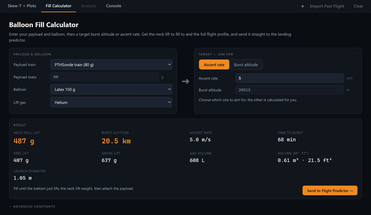
A balloon fill calculator sizes your gas fill for a target ascent or burst, and a GFS landing predictor calls the landing spot and refines it live.
Free & open source
Runs as a Windows app or a browser-based dashboard — no account, no license. The source lives on GitHub.
A closer look
Inside the dashboard
Specifications
The numbers behind it
The app
| Platform | Windows app or browser-based |
| Input | USB serial from the ground station (CSV telemetry) |
| Live views | Skew-T, time series, map, system health |
| Analysis | Full SPC sounding panel per flight |
| Planning | Balloon fill calculator + GFS landing predictor |
| License | Free & open source |
Complete the kit
Goes well with
PTHSonde
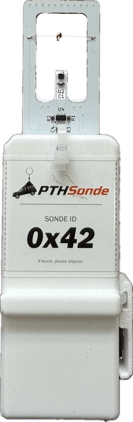
A complete, reusable radiosonde system — pressure, temperature, humidity, wind, and GPS, streamed to a desktop ground station with a full sounding analysis.
PTHSonde Ground Station
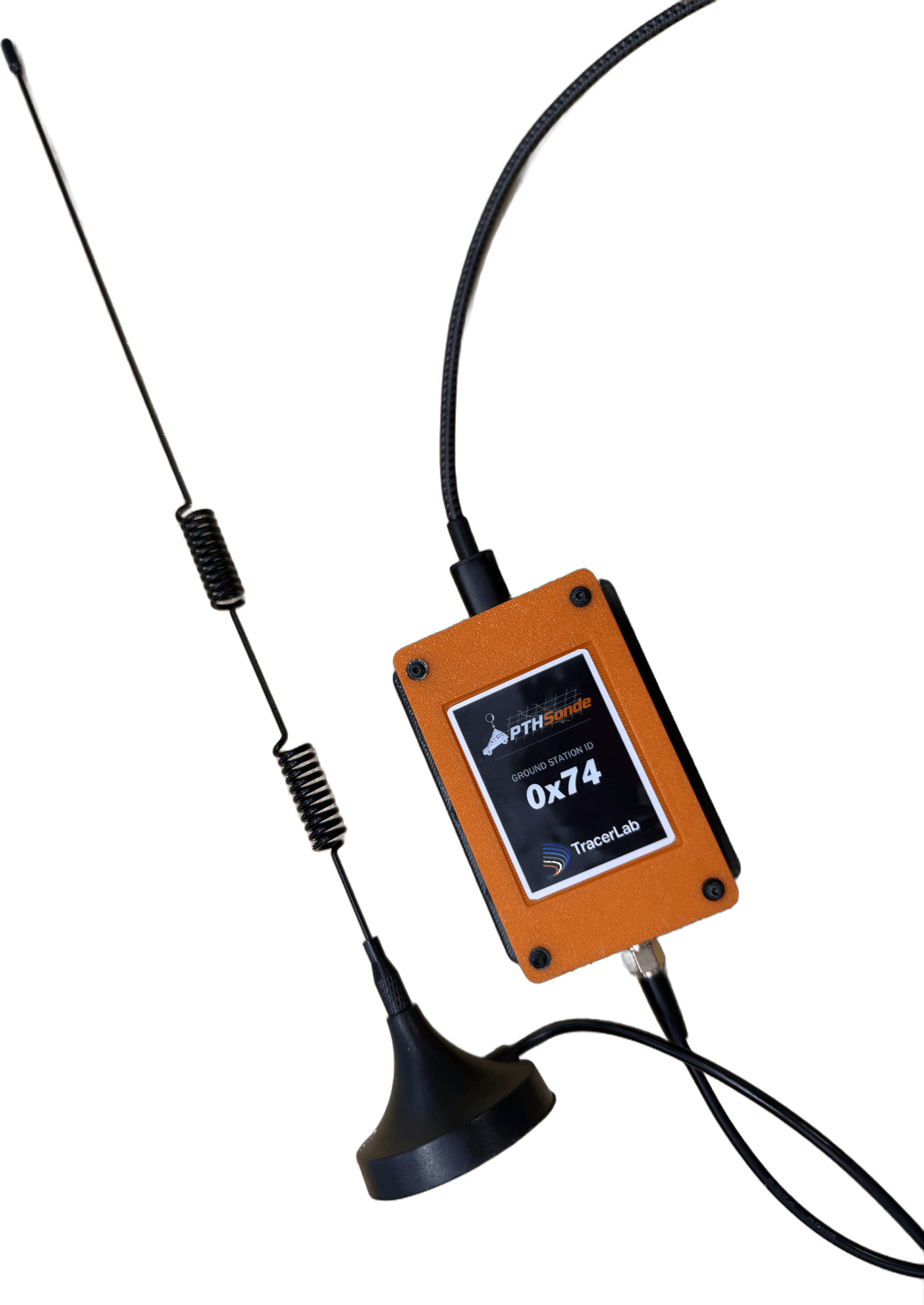
The receiving end of the PTHSonde link — a 915 MHz LoRa receiver that decodes telemetry in real time and streams it to the desktop app over USB.
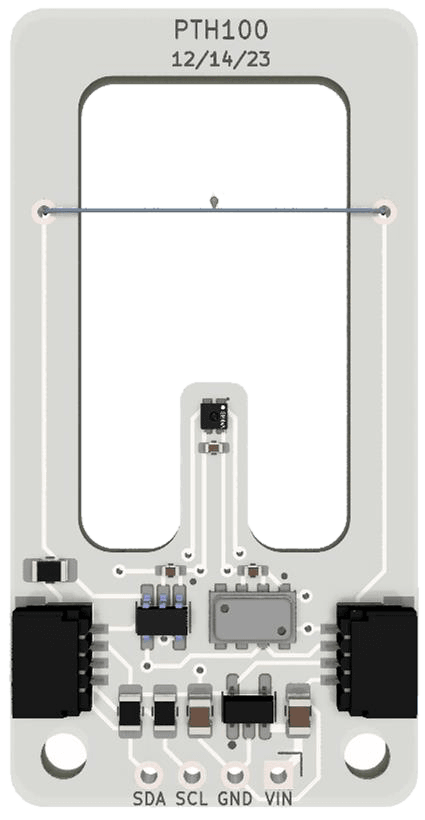
PTH100 Sensor Breakout
The PTHSonde's pressure, temperature, and humidity suite as a research-grade I²C breakout — Qwiic plug-and-play, 3.3–16 V input, flown on balloons, drones, and aircraft.
Free download
Get the Ground Station Software
Free and open source — run the Windows app or the browser-based dashboard. No account, no license.